Take a limestone crag standing out of a wide farming valley, occupy it for three and a half thousand years, and Tlos is roughly what you get. A fortress on the summit. Tombs cut into the cliff below. A Roman town spilling across the flat behind.
Of the inland sites within a day of the coast, it rewards a slow visit most and gives you the least help doing it.
Nobody can date its founding. Hittite tablets of the fourteenth century BC name a place called Dalawa in the land of Lukka, and the identification with Tlawa — the name the city gives itself in its own Lycian inscriptions — is widely accepted. One of the oldest settlements in Anatolia anyone can still walk around, then, and most visitors reach it by accident on the way to a gorge.
The crag, and everything stacked on it
You see the acropolis long before reaching it: a grey outcrop lifting a couple of hundred metres out of the greenhouses and cotton, with masonry on its skyline that does not look quite ancient. It isn't. What crowns the rock is a nineteenth-century fortress, put up by a local ağa — a provincial lord — remembered as Kanlı Ali, "Bloody Ali", a name earned rather than inherited.
Which is the point, really. Kanlı Ali built on Byzantine walls; the Byzantines on Roman; the Romans on Lycian foundations — four occupations on one hill, visible in a fifteen-minute climb if you look at the joins.
From the top the view runs north up the Eşen Çayı, the ancient Xanthos river, to the Akdağ massif, over three thousand metres and white into May. Ten minutes on that wall explains the geography of ancient Lycia better than anything printed on the site's boards.
A cliff face full of doorways
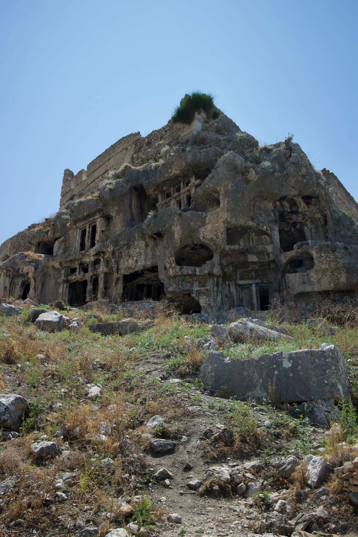
Beneath the summit, on the eastern face, the rock is perforated with tombs. Dozens of them, cut over several centuries and stacked at every height, some reachable on a scramble, some hanging above nothing at all.
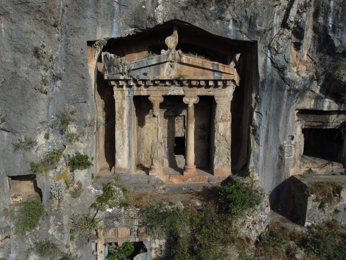
Lycians cut their dead into rock in a distinctive way, copying the timber houses they lived in — beam-ends, ridge poles, plank doors, all rendered in limestone. Others take a temple front with columns and a pediment. From below it reads as a residential street turned vertical.
Very little of it is fenced or marked, which cuts both ways. Nothing stands between you and a fourth-century BC facade; equally, nothing tells you which tomb is which, and the path up is loose gravel with a drop beside it.
The hero on the winged horse
One tomb carries the site's calling card. Behind a porch with two columns, its left wall bears a relief of a rider on a winged horse — read universally as Bellerophon on Pegasus, turned towards what is generally taken for the Chimaera. Lions face each other inside the chamber.
Myth put Bellerophon in Lycia: exiled from Corinth, sent to King Iobates with a sealed letter requesting his own death, handed the Chimaera to kill. Lycian coinage later carried Pegasus, and local tradition made the hero a resident here.
Manage expectations about the relief. Weather has flattened it, and at midday in full glare it reads as little more than a shape in the stone. Early morning, sun low and raking across the face, is when it shows.
Theatre, stadium and seven arched windows
Across the lane, the Roman town spreads over the flat and is far easier walking. Its theatre is the obvious draw: a Roman rebuild on Hellenistic bones, seating over two thousand, its stage building collapsed into a field of carved blocks — masks, garlands, cornices — laid out on the grass by the excavators.
Money for that rebuild came partly from Opramoas of Rhodiapolis, who financed reconstruction across the province after the earthquake of AD 141. Tlos took his money along with everyone else.
North of it runs the stadium: a terrace about a hundred and fifty metres long with seating down one side, a large hall alongside. Cows graze it.
Best preserved of all is the bath complex at the southern edge, known as Yedi Kapı, "seven doors", for the arched openings in its curved end wall. They frame the entire valley. Photographers go straight there; most other visitors never find it, which says something about the signage.
| Feature | Period | Where it sits |
|---|---|---|
| Rock-cut tombs | 4th century BC onward | East cliff face, below the summit |
| Acropolis walls | Lycian, rebuilt Byzantine | Wrapping the crag |
| Kanlı Ali's fortress | 19th century | The summit itself |
| Theatre | Roman, 2nd century AD | Across the lane, on the flat |
| Stadium and hall | Roman | Terrace below the acropolis |
| Yedi Kapı baths | Roman, later reused | South end, facing the valley |
Why did this place matter?
Lycia in the second century BC organised itself into something unusual for the ancient world: a federal league of twenty-three cities, votes allocated by size rather than shared equally, a rotating magistrate and a common court. Tlos held one of six top-tier seats worth three votes each, alongside its valley neighbours Xanthos and Pinara. An inscription here calls it "the very brilliant metropolis of the Lycian nation" — the sort of thing only a city with real standing bothers to carve.
That constitution outlived the league. Montesquieu praised it as a model federal republic and the American founders read Montesquieu, so a hill in Muğla province holds a footnote in the design of federal government. Nothing on the site mentions it. Systematic excavation, meanwhile, began only in 2005, under Akdeniz University.
Getting there, and the shade problem
By car from Fethiye it is about 42 km, roughly 45 minutes: east on the D400, inland on the Saklıkent and Korkuteli road, then a signed turn and a narrow climb through Yaka. From Dalaman Airport, allow around 90 km and an hour and a half. Roads are good until the last few kilometres, single-track in places and carrying farm traffic.
Interpretation is thin. A handful of boards, several faded past reading, and no marked route between the acropolis, the tombs and the lower town. Arrive with something to read and the visit changes completely. Without it, people wander for forty minutes, decide there isn't much here, and leave having missed the baths.
Without a car this is genuinely awkward. Seasonal dolmuş minibuses from Fethiye run towards Saklıkent, but Tlos sits off that road and what serves Yaka is sparse, timed for villagers rather than visitors. Expect a walk of several kilometres in the heat, a negotiated taxi, or a wasted afternoon — local transport in this province defeats the inland sites generally.
No shade exists on the acropolis. None on the climb, none at the top, very little among the tombs. In July and August the rock throws heat back at you from mid-morning until late afternoon. Come before ten or after four, carry more water than seems reasonable, and wear shoes with grip — loose stone, not steps.
Tickets are sold at a small gate; the site falls under the Ministry of Culture and Tourism, is covered by the national museum pass, and current hours sit on the ministry's museums portal. Winter closing is earlier. Allow ninety minutes at pace, two hours to climb properly.
Building a day around it
Tlos pairs almost automatically with Saklıkent gorge, about 15 km and twenty minutes further up the same valley. Ruins in the cool of the morning, meltwater in the afternoon once the heat has turned unpleasant — that order, not the other way round.
Lunch, by convention, happens between the two at the trout farms around Yaka: spring water running in stone channels along the tables, alabalık — trout — from the farm's own pools, gözleme alongside, the thin griddled flatbread folded around cheese or potato. Touristed, cheap, and cold enough under the plane trees to justify the stop.
A workable shape for the day:
- Leave the coast by eight. The climb is a different proposition at nine than at one.
- Tlos until about eleven. Tombs and fortress first, lower town after.
- Yaka for lunch. Twenty minutes away, under the plane trees.
- Saklıkent from two. Wading is more bearable and the gorge light better later.
If ruins interest you more than water, pair it instead with the abandoned village at Kayaköy on the other side of Fethiye — a different sort of emptiness, a shorter drive. Seasonal opening across Türkiye's archaeological sites is summarised by the national tourist board, though ground truth is whatever the gatekeeper says on the day.
Go in April or May if the choice is yours. Valley green, wildflowers through the stadium, Akdağ still white behind the theatre, and heat that a shadeless hill can survive.